 Civilizations that existed on our planet in ancient times have left us a rich heritage in the form of various monumental and megalithic structures. They are everywhere. On all continents, in the howling jungle, lifeless deserts, in steppes and mountains, on large and small islands, sometimes lost in the ocean.
These structures, often thousands of kilometers apart, belong to different eras, and according to academic science, different civilizations.
And although the ancient objects differ, both in form and in the method of manufacture, there is much in common between them. First of all, they are unified by a huge amount of work performed.
If the creation of monumental buildings were the work of human civilization, then for several millennia all its main activities, apart from other concerns, should have been aimed at creating pyramids, temples, dolmens and other megalithic structures, which are present on the planet not even in hundreds of thousands, but in millions. We are unable to reproduce some of these objects even now, with all our "civilization". And in some cases, we cannot even understand how they have been made.
Another characteristic feature of the ancient architecture is the high-precision processing of huge arrays of hard stone rocks, which is impossible without the use of special machines and tools. Almost everywhere, beautifully processed monolithic blocks weighing tens and sometimes hundreds of tons have been used in construction. As a rule, they are carefully fitted and installed without gaps or binder solution.
There are thousands of high-tech products made of hard stone that allow you to assess the level of possibilities of unknown sculptors. These are sarcophagi, columns, giant obelisks and statues. There are many temples carved in the rocks and whole cities underground. There is a distinct impression that for the ancient builders granite was not harder than oil, and the weight did not matter at all. It seems that it was easier for them to work with huge boulders than to mess with small blocks.
Architectural techniques and forms of ancient buildings have much in common. Almost everywhere there are pyramidal structures, dolmens of Europe and the Caucasus are very similar to those of Asia and America. Rock paintings depicting mysterious creatures and geoglyphs visible only from a great height are similar. City planning and construction methods are similar. Many objects have the same astronomical and geodetic properties.
To put it in a nutshell, the version that in the past, perhaps not so distant by historical standards, there was an integrated megalithic civilization on our planet, is supported by very solid grounds. It explains very well why there is so much in common between different buildings located on different continents.
Developing this theory, it is reasonable to assume that the most ancient architectural objects were created by the same architects, according to a single project, and it is quite possible that there are even more relations between them to be discovered.
Taking this premise as a working hypothesis, within the framework of the “OBJECTIVE HISTORY” project, we tried to combine information on various historical sites into one whole, in the attempt to understand what the relation between the ancient buildings really is and what they were originally intended for.
Over the 10 years of the project’s existence, a huge number of obvious regularities in the location of ancient monumental structures have been revealed. It turned out that most of them - pyramids, temples, megalithic structures and many other objects can be combined into a wholesome, logical System, based on mathematical relationships and angles of regular geometric shapes. The starting point of the System’s reference is the Great Pyramid at Giza, and its meridian is the true zero meridian of the Earth.
The whole system, with the help of lines, geometric figures and designated centers, is graphically depicted in the Nazca desert. This is the solution to the mystery of its geoglyphs, which, most likely, are a flight map and display the location of objects relative to each other, allowing one to navigate and move over the planet. One can also say that the lines in the Nazca desert are a kind of passport - the bar code of our planet, bearing all the necessary information about it in coded form.
Today, it is already safe to say that the Earth has a system of ancient monumental structures (SAMS), which also includes not very ancient objects, just a few hundred years old.
Site structure
HISTORICAL OBJECTS
All Historical Objects, on the site, divided into two main characteristics:
 By category - Pyramids, Megaliths, Ancient cities, Dolmens, Geoglyphs, Rocky Villages, Petroglyphs, Processed Stones, Temples and palaces, Barrows and ziggurats, Natural Objects and Terra Incognita.
By geographical location - Africa, Asia, Europe, Russia, North America, South America, Australia, the Indian, Atlantic and Pacific oceans.
Objects can be grouped in various ways. If now you click a link at the top of the geography, for example "RUSSIA", you'll see all the objects in Russia, which has information on the site, if "AUSTRALIA", respectively, all objects in Australia. Then clicking one of the links categories to the left, eg "MEGALITHS"you will see all the megaliths of Australia or Russia, depending on what geographical link was clicked before. Similarly, clicking the link now categories such as "ANCIENT CITIES", you will see all the ancient cities, which have information on this site. Then clicking the link above, for example, "ASIA", you will see all the ancient cities of Asia.
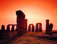 How to find, for example Stonehendge? You must first press the "EUROPE", then "MEGALITHS" or vice versa, first "MEGALITHS", then "EUROPE". On the next page you will see the megaliths are located in Europe, among which is Stonehenge. Clicking on the picture with his image, you get a compilation of information on this historical object.
If you are interested in a specific object, and you know its name, you can use the search on the site.
NEWS
In this section, you can learn about new publications and updates files and other changes occurring at the site.
PUBLICATIONS
Here are the most interesting materials related to ancient history.
ONWARD TO THE PAST - PUBLICATIONS DEVOTED TO THE MOST ANCIENT HISTORY OF OUR PLANET.
NAZCA LINES - PUBLICATIONS DEVOTED TO RESEARCHES OF IMAGES IN NAZCA DESERT.
HISTORICAL GEODESY - PUBLICATIONS DEVOTED TO RESEARCHES OF LAWS IN THE ARRANGEMENT OF ANCIENT HISTORICAL OBJECTS.
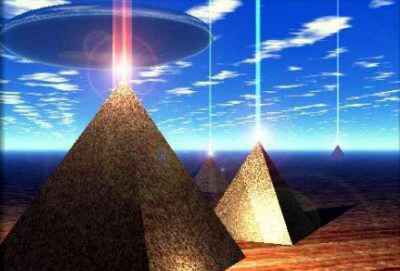
Pyramids and megaliths, scattered around the world, have always had and will probably continue to have a major impact on the development of our civilization. Is their location, directly connected with the geodetic parameters of the Earth and, most likely, not only to them.
At least, in the arrangement of the most famous ancient sites revealed a clear system that combines them into a single network. This system may have a different purpose and use, for example, to navigate or monitor plate movements. Pyramids, covering the entire planet, can serve as the receiver and / or transmitter of certain energy to provide space communications, the principle of spaced radio telescopes with known coordinates.
To imagine how this might work it's recommended to watch a documentary film "Mysteries of History. Aliens and the secret code . " The movie shows a symmetric system based on geometric principles to the key points of which are attracted to the historical centers of civilization.
In SAMS system, to which the section "Historical Geodesy" on our website is devoted, on the contrary build symmetrical network, obtained through a line connecting the ten most significant buildings of antiquity, among them, the Great Pyramid, Stonehenge, Teotihuacán, Tiwanaku, Easter Island, Angkor, Baalbek, Nan Madol, Great Zimbabwe and Uluru. In fact, we just connect the lines, in various combinations, the same objects, discovering new and new laws that leave no doubt about the general availability of the planetary system of monumental buildings.
ALIGNMENTS SYSTEM - description of the individual patterns found in the System.
HISTORY ON-LINE - HISTORICAL NEWS NETWORK.
FILES
Files are divided into three groups.
HISTORICAL OBJECTS
This file contains historical objects are grouped, as well as on the site in 12 categories. The pyramids, megaliths, ancient cities, etc. Objects are mapped in the form of labels, which are available at any of its scale and contain the information on this subject. The file includes many objects that are not reflected on the site due to insufficient information about them.
NAZCA LINES
In this file as lines on the map plotted the real image in the Nazca desert, visible from space. Opening this file, you can watch the Nazca lines in real, from any height and any angle.
HISTORICAL GEODESY
This file will be displayed on the map known for today information relating to the laws of the geographical location of historical sites.
To acquaintance you can send a free subscription at any E- mail demonstration files that are distributed for free, or open them in Google Earth.
The files will be continuously updated, but all subsequent ones, will contain all the previous information. Thus, sending a next update you can simply remove the earlier file and replace it with new one.
We recall that the data files can be opened only if you have installed Google Earth.
PHOTO
Section contains thousands of photographs of various historical objects around the globe.
FORUM
Site forum.

Full set of Interactive Maps

A lot of thematic films

 Sensational! Tens of thousands of unknown geoglyphs have been found in the Sahara.


